TRAVEL IN KOREA
Korea Places to Visit
Find attractions, culture, festivals, stays, restaurants, shopping and travel courses for a clear Korea trip plan.
Data last synced: 2026-06-25. Some details may change. Please confirm official information before visiting.
Sacheonjinhaebyeon Beach (Sacheon Dwitbul Beach)(사천진해변(사천뒷불해수욕장)
111 Jillihaebyeon-gil, Sacheon-myeon, Gangneung-si, Gangwon-do
Sacheonjinhaebyeon Beach is wide and shallow sand beach situated in Sacheonjin-ri, Gangneung-si. Spanning 800 meters in length and covering a land area of 16,000 square meters, it is conveniently located right next to Sacheon Port. This proximity allows for easy access to fresh fish, along with opportunities for fishing and yachting. Just a 10-minute car ride away from the Gyeongpodae Pavilion, the beach is also surrounded by numerous cafés along the seaside, making it an ideal spot for coffee enthusiasts.

Saebyeol Oreum Volcanic Cone (새별오름)
San 59-8 Bongseong-ri, Aewol-eup, Jeju-si, Jeju-do
Located in Bongseong-ri, Aewol-eup, Jeju-si, Saebyeol Oreum Volcanic Cone is a parasitic volcano cone set alone that looks like a lonely star (Saetbyeol in Korean) in the night sky, giving this volcano cone its name. Based on the highest south peak, small peaks continue in the northwest direction, forming an oval-shape. The oreum is a mid-sized oreum among 360 oreums on Jeju Island and it features a stunning view from the peak of the beautiful ridges connecting to one another.
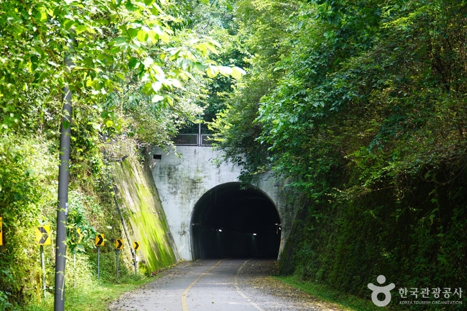
Saekhyeon Tunnel (색현터널)
Sangcheon-ri 1628-3, Cheongpyeong-myeon, Gapyeong-gun, Gyeonggi-do
Saekhyeon Tunnel, spanning 423 meters in length, was first opened in 1939 and functioned as part of the Gyeongchun Line railway up until 2010. After the railway line was rerouted, the tunnel found a new purpose as a section of the Bukhangang Bike Path. It has also earned the nickname "Moss Tunnel" due to the moss that has grown around its entrances. The tunnel, especially known for its distinctive round entrances, has become a favored location for photography enthusiasts.
Saekjang Rice Mill (색장정미소)
2-15 , Wonsaekjang-gil, Wansan-gu, Jeonju-si, Jeonbuk-do
Saekjang Rice Mill, located approximately 5 minutes by car from Jeonju Hanok Village, is a unique cafe that transformed an old rice mill from the 50s. The cafe exhibits antique art works perfect as a photo spot, but the best photo zone is on the second floor that will take you back in time.
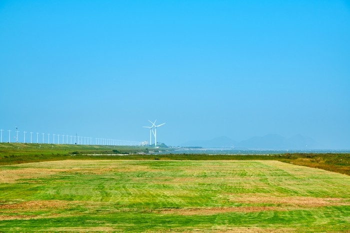
Saemangeum (새만금)
6 Saemangeum-ro, Byeonsan-myeon, Buan-gun, Jeonbuk-do
Saemangeum is an area created by the reclamation project to build a sea wall connecting Gunsan and Buan. After 20 years of construction, the Saemangeum Seawall was completed in 2010. Stunning sunsets can be seen from the dike, and various facilities such as campgrounds and the Saemangeum Project Office are well prepared for visitors experience. It is also known as a filming location for BTS's music videos.
Saengki Korean Medicine Clinic (생기한의원 강남역)
14th Floor, Ara Tower, 3 Seocho-daero 77-gil, Seocho-gu, Seoul
Give treatment of skin diseases such as atopic dermatitis, psoriasis, eczema, hives, seborrheic dermatitis, warts, and pompholyx(dyshidrotic eczema) Micrographic skin diagnosis for the first time in Korea Development of the stilled medicinal wet dressing Patent moxibustion for warts and condyloma Presentation of papers at the World Conference Treatment method: herbal medicine and pills tailored to one's constitution / pharmacopuncture, acupuncture, moxibustion, light treatment according to symptoms / lifestyle guidance suitable for one's personal tendency
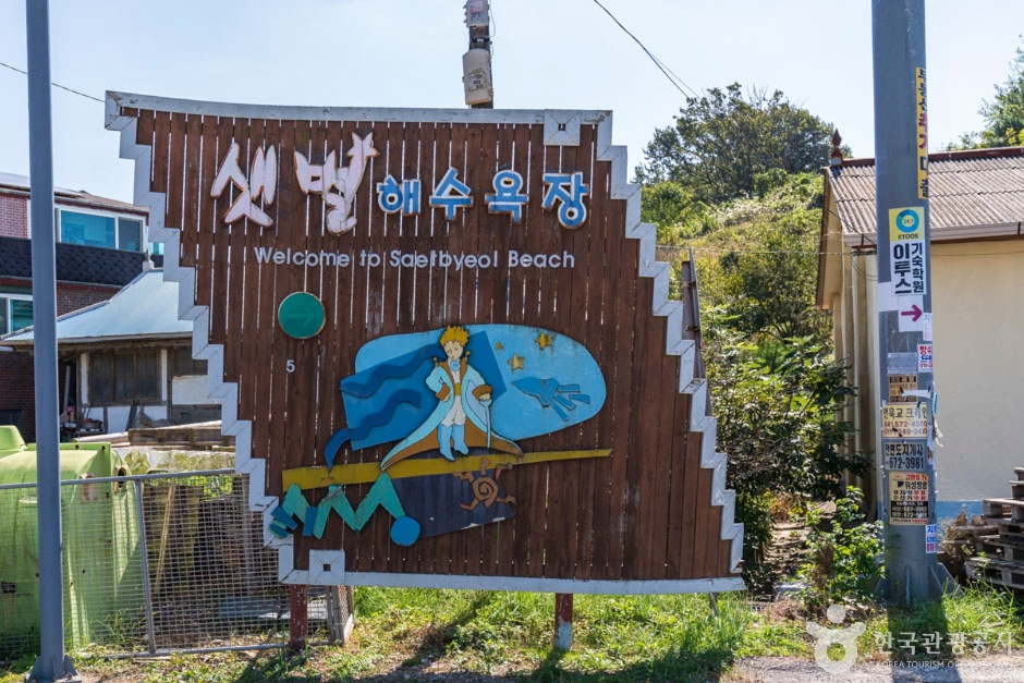
Saetbyeol Beach (샛별해수욕장)
184-2 Saetbyeol-gil, Anmyeon-eup, Taean-gun, Chungcheongnam-do
Saetbyeol Beach is situated on the western side of Anmyeondo Island. It features a balanced mix of sand and pebbles, offering a stunning view of the Yellow Sea and distant islands. Additionally, a glamping campground and nearby pensions provide accommodation options, allowing visitors to enjoy the scenic beauty of Korea's rural villages and fields.

Saeyeongyo Bridge (Saeseom Island) (새섬 새연교)
40 Namseongjung-ro, Seogwipo-si, Jeju-do
Saeyeongyo Bridge connects Seogwipo Port to the uninhabited Saeseom Island. Its name means "a bridge creating new relationships." The walking path features musical benches and is renowned for its sunset and night views. There is a beautiful musical fountain show twice a day. It's a pleasant walk from Cheonjiyeonpokpo Falls, crossing the Saeyeongyo Bridge to Saeseom Island.
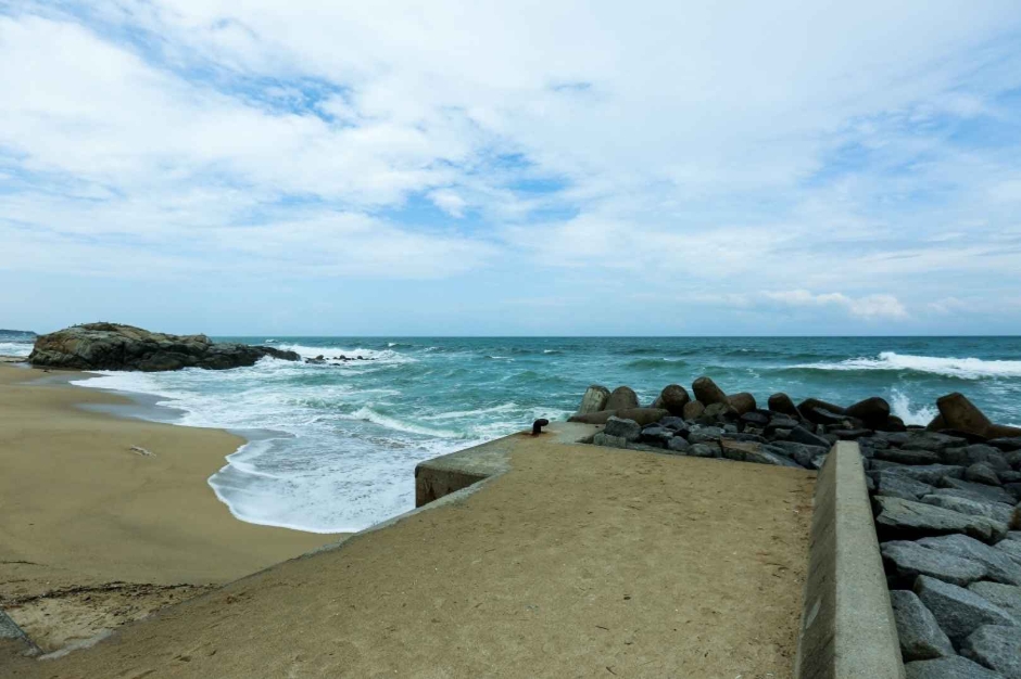
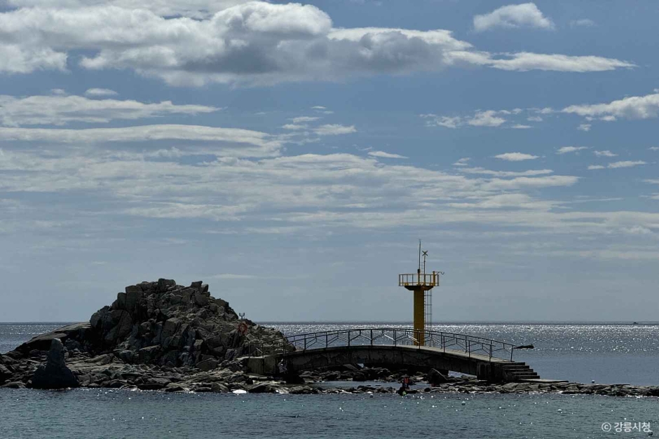
Sageunjinhaebyeon Beach (사근진해변(사근진해수욕장))
16 Haean-ro 604beon-gil, Gangneung-si, Gangwon-do
Sageunjinhaebyeon Beach is a white sandy beach connected to Gyeongpohaebyeon Beach in Anhyeon-dong, Gangneung. The beach area is lined with small, private accommodations, and the beach is complete with changing rooms, drinking fountains, and parasol rentals. The beach is backed by a pine tree forest.
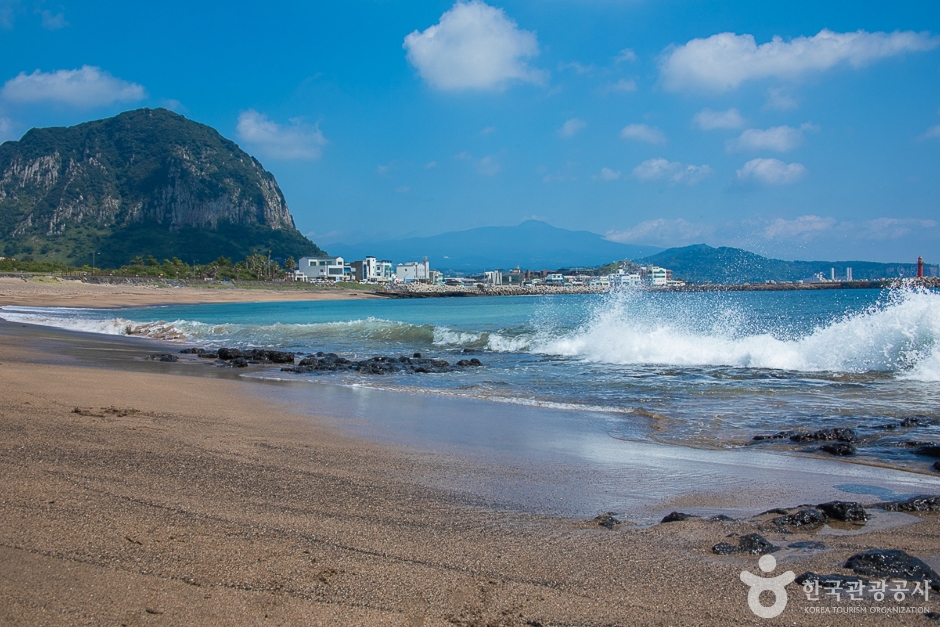
Sagyehaebyeon Beach (사계해변)
2147-35 Sagye-ri, Andeok-myeon, Seogwipo-si, Jeju-do
Sagyehaebyeon Beach is located at the foot of Sanbangsan Mountain. Created by wind, waves, and the geological features of the sedimentary layers in Hwasun-ri, the large and small marine potholes look like craters on the moon. Due to the geographical characteristics, the scenery is more beautiful if seen at low tide.
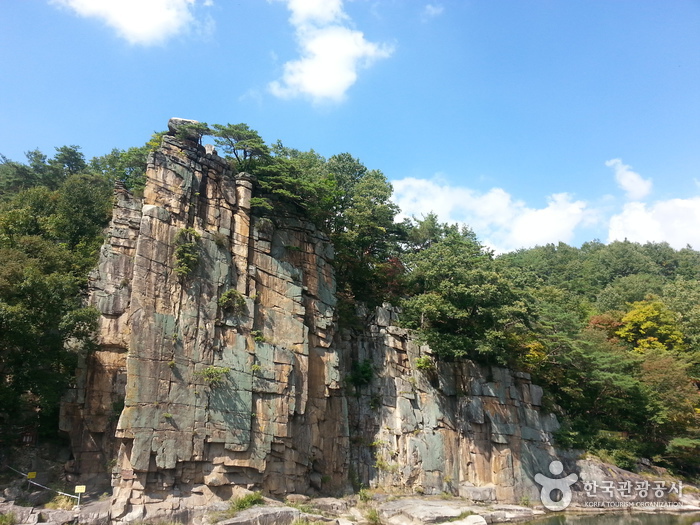
Sainam Rock (단양 사인암)
42, Sainam 2-gil, Danyang-gun, Chungcheongbuk-do
Sainam Rock, located in Sainam-ri, Daegang-myeon, is one of eight scenic areas in Danyang, and is located in the southeast side of Danyang-gun, along with Sangseonam Rock, Jungseonam Rock, and Haseonam Rock of Seonam Valley. The Sainam Rock is a rugged outcropping with an inspiring x_height of 70 meters, and the deep blue Namjocheon Stream passes in front of it, located in the southern part of Danyang-gun. Most visitors to Danyang Eight Scenic Views tend to come to the rock as their first destination due to the good condition of the road. Also, Unseongugok Valley flows in front of Sainam Rock. The rock was picked as the most picturesque place among the Eight Scenic Views. On the cliff, there is a phrase carved by Utak’s own handwriting, as well as old pine trees on a rock floor that is reminiscent of the Haegeumgang River. Sainam was named after the great scholar Yeokdong Utak during Goryeo Period. He had taken up a public service to assist a king in a position called sain (사인), and then he retired to his hometown of Danyang, starting out teaching young students. For this story, a governor of Danyang named the rock Sainam to commemorate his achievement during King Seongjong of the Joseon Dynasty.
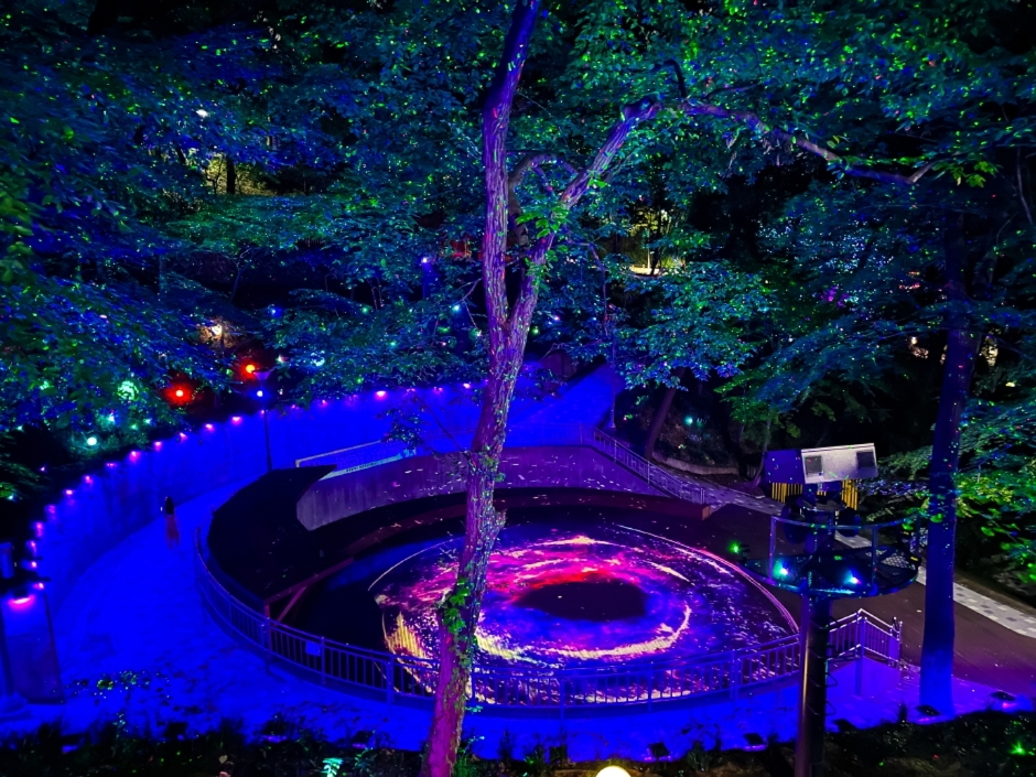
Sajik Forest of Light (사직 빛의 숲)
49 Sajik-gil, Nam-gu, Gwangju
Located within Sajik Park, the Forest of Light is a popular night view spot with a fantastic media art that incorporates historical themes of Gwangju. The space features a combination of lighting, video, and music to create multimedia contents, offering a variety of experiences and attractions through interactive art that responds to people's movements. The observation tower hosts a light show, and visitors can enjoy video contents through an AR telescope.
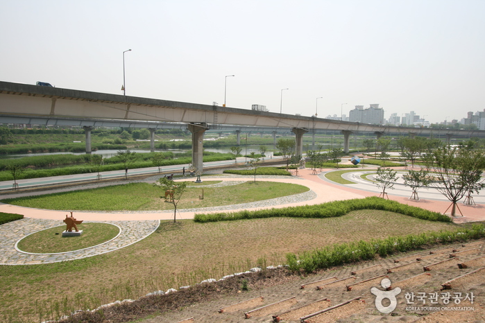
Salgoji Sports Park (살곶이 체육공원)
16-18 Sageundong-gil, Seongdong-gu, Seoul
Salgoji Sports Park is located along the Joongnangcheon Riverside near Hanyang University. Its name "Salgoji" holds deep historical significance, meaning "the place where an arrow is shot" in Korean. The park features facilities such as an inline skating rink, soccer field, basketball court, and badminton court. There are dedicated bicycle paths and pedestrian walkways around the park. Throughout the year, walking festivals and mini marathons are organized, making it a beloved spot among cyclists. In the summer, an outdoor water playground is operated.
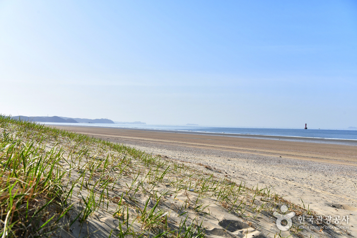
Sambong Beach (삼봉해수욕장)
Anmyeon-eup, Taean-gun, Chungcheongnam-do
Sambong Beach is located to the south of the bridge that connects Nammyeon and Anmyeon-eup. The beach stretches 3.8 kilometers and has a x_width of 300 meters. The beach gently slopes down at a 6° angle and has an average water depth of 1.5 meters with a temperature of 22° C. The three Sambong Rocks, the Haedanghwa flower (plena) and the rich pine forests are just a few of the beautiful and magnificent features of this beach. Also, the beach attracts many visitors during summer because it has convenient transportation making it easily accessible.
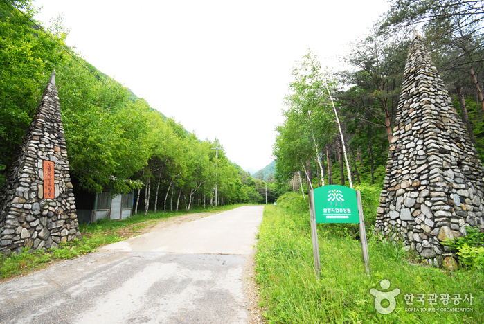
Sambong National Recreational Forest (국립 삼봉자연휴양림)
276, Sambonghyuyang-gil, Hongcheon-gun, Gangwon-do
Located in Odaesan National Park, Sambong National Recreational Forest is filled with large acicular trees like fir and broad-leaved trees like birch. Lenoks, a species of freshwater fish that are considered a Korean natural treasure, found only in the cleanest water, thrive in the waters of the deep valley running through the park. The park is surrounded by three peaks – Gachilbong Peak (1,240 meters), Eungboksan Mountain (1,155 meters), and Sasambong Peak (1,107 meters). Sambong Mineral Spring is found In the middle of the three peaks. The spring’s waters are said to ease stomach complaints. The park is also popular since visitors can see beautiful fall foliage in autumn while enjoying the mountains and sea at the same time in summer.
![Sambuyeonpokpo Falls [UNESCO Global Geopark] (삼부연폭포 (한탄강 유네스코 세계지질공원)](http://tong.visitkorea.or.kr/cms/resource/38/1750438_image2_1.jpg)
Sambuyeonpokpo Falls [UNESCO Global Geopark] (삼부연폭포 (한탄강 유네스코 세계지질공원)
Sincheorwon-ri, Galmal-eup, Cheorwon-gun, Gangwon-do
Sambuyeonpokpo Falls, among the nine scenic spots in Cheorwon, is a three-tiered waterfall standing at approximately 20 meters high, situated in the granite area of Myeongseongsan Mountain. This natural wonder was formed by water flowing over an extended period subsequent to the exposure of granite intrusion from the Mesozoic Cretaceous period, estimated to be around 110 million years ago. The name "Sambuyeon" originates from the distinctive three bends in the water stream and the lower part of the waterfall's resemblance to a cauldron.
Plan your Korea trip
Korea travel FAQ
How do I use the travel search?
Enter a place or interest, then narrow the results by region, category or sort order.
Will my filters stay selected on the next page?
Yes. Your search and filter choices stay in the page URL while you move through the results.
Can I find directions to each place?
Place pages include an external Google Maps search when coordinates or an address are available.
Source: Korea Tourism Organization, official website (https://knto.or.kr).